
| After 1850...
|
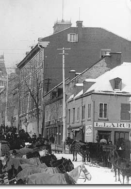
After 1850, new hotels were built here and, along with those on Rue Saint-Paul, made this an important hotel district. The square itself was livelier and friendlier than ever, with its market gardeners and their stalls, its restaurants and shops, all just moments from the Port. Even some manufacturers remained, with a large shoe factory opening here in 1867. |
 An Amerindian trail, then a "castle"... |
Right up until the 1950s, the market was open two days a week, still as an outdoor extension of the Bonsecours Market, the city's central marketplace. Even today, the flower vendors and the artists' easels are discreet reminders of this earlier role. |
| Home | Site map | Contact us |
Credits. All rights reserved, 1998-2001.
|