HomeSite mapContact-us
Around Rue de l’Hôpital


Tour route Next section Previous section Back to Notre-Dame Est Boulevard Saint-Laurent Rue Notre-Dame West The Old Seminary and Notre-Dame Place d’Armes Rue Saint-Jacques Des Récollets Around Rue de l’Hôpital Rue Saint-Paul, near Place d’Youville Place d’Youville Western end of the Old Port Pointe-à-Callière and Place Royale Saint-Paul and de la Commune From Saint-Amable to Saint-Gabriel Place Jacques-Cartier Eastern end of the Old Bonsecours From Bonsecours to Berri Rue Notre-Dame East Champ-de-Mars
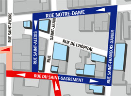
Rue de l'Hôpital takes its name (and direction) from the early days of Ville-Marie, when it was one of the paths converging on the Hôtel-Dieu hospital. The colony's first hospital, located in the centre of the settlement, also served as a refuge in case of attack. And there was no shortage of attacks... This block has been transformed over and over again, and is lined with buildings devoted to the stock market, shipping, telegraphy, technological innovation and good food... a curious mixture of functions, reflected in the diversity of symbols, materials and shapes.


Down to the water

Business and stone

Telecommunications

And fires!


Detailed neighbourhood map

The H.T. Privett restaurant
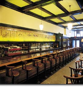
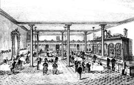
The H.T. Privett restaurant, built in 1874 (Rue de l'Hôpital), was popular with members of the Merchants' Exchange, close by on Rue Saint-Sacrement.

Delmo’s restaurant
Delmo’s, a restaurant located behind this bar, has long been part of Old Montréal's gastronomic tradition.


Top of page

| Home | Site map | Contact us |

Old Montréal

Credits. All rights reserved, 1998-2001.
Last updated: September 2001