
| Saint-Laurent marks the dividing line down the centre of Montréal, for it is here that street numbers start and proceed east and west. This cosmopolitan artery, also known as "The Main," has been home to generations of immigrants as they began their new life in Montréal.
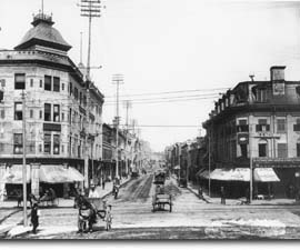
During the days of the fortified town, Saint-Laurent started at the gate of the same name and led to the interior of the Island, passing through the Faubourg Saint-Laurent. At the turn of the century (in this case circa 1890), this "boulevard" was the route into the city for immigrants from all over the world. |
 |
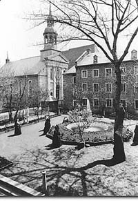
Up until 1912, the southern end of the Boulevard stopped at the property of the Congrégation de Notre-Dame, the religious order founded by Marguerite Bourgeoys. The convent was sacrificed to allow Saint-Laurent to extend all the way to the Port. Remains of the convent still lie underground, and some artifacts can be seen in the Cuvillier-Ostell house. |
 |
| Home | Site map | Contact us |
Credits. All rights reserved, 1998-2001.
|