Old Montreal Home Old Montreal Site Map Old Montreal Contact us


Click on the map to enlarge it.

HEART OF THE UNDERGROUND PEDESTRIAN NETWORK

Montreal's underground pedestrian network, which began beneath the Central Station complex, took off during the 1960s when Place Ville-Marie was built.

This initial core would expand considerably with the construction of Place Bonaventure. The metro, which opened in 1966, would extend it much farther still.

Here too, the transportation infrastructures criss-cross and complement each other. The elegant Place Bonaventure metro station, for instance, designed by Montreal architect Victor Prus, links the CN complex with the rest of the city and allows pedestrians to reach Windsor Station without venturing outdoors.


Other cities have tried to construct networks sheltering pedestrians from inclement weather, 
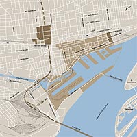
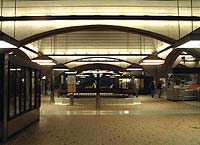
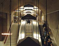
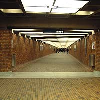
but the Montreal system, the world's longest and best-known, with its kilometres of corridors and shopping promenades, has clearly managed to pull together all the right conditions to enjoy great popular success.

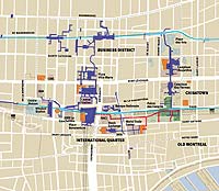
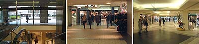
The underground city is still growing today. In recent years, a link has been added between Place Ville-Marie and shopping centres farther north, themselves linked to another metro line. Another recent connection gives access to the southeast, to the Stock Exchange tower and a new urban complex, and even to a gateway to the historic city centre, where pedestrians can stroll along the narrow streets, outdoors.


THE RAILWAY STATION DISTRICT
WINDSOR STATION AND ITS
VICTORIAN SURROUNDINGS
CENTRAL STATION AND
ITS MODERN COMPLEX
PLACE VILLE-MARIE
HEART OF THE UNDERGROUND
PEDESTRIAN NETWORK
TWO RAILWAY STATIONS
IN THE HISTORIC CITY CENTRE
THE VICTORIA BRIDGE
     
 
 Top
 

| Home | Site Map | Contact us |

Old
Credits. Rights reserved, 1998-2003.
March 2003