HomeSite mapContact-us
Place Jacques-Cartier


Tour route Next section Previous section Back to Notre-Dame Est Boulevard Saint-Laurent Rue Notre-Dame West The Old Seminary and Notre-Dame Place d’Armes Rue Saint-Jacques Des Récollets Around Rue de l’Hôpital Rue Saint-Paul, near Place d’Youville Place d’Youville Western end of the Old Port Pointe-à-Callière and Place Royale Saint-Paul and de la Commune From Saint-Amable to Saint-Gabriel Place Jacques-Cartier Eastern end of the Old Bonsecours From Bonsecours to Berri Rue Notre-Dame East Champ-de-Mars
 

Place Jacques-Cartier
Place Jacques-Cartier in 2001.

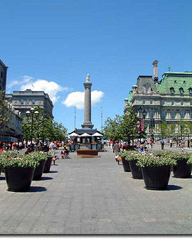
The square was built here by the city in the first half of the 19th century, but this initiative was simply an acknowledgement of a much older reality. As archaeologists have found, people have gathered at this site for generations. It has always been one of the most popular spots in Montréal! 


Place Jacques-Cartier 

Place Jacques-Cartier

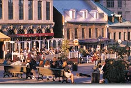
Look at all the people! As it always has, Place Jacques-Cartier attracts sun-seekers as soon as the first yellow rays begin chasing the winter blues away. 

Place Jacques-Cartier


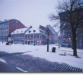
An Amerindian trail, then a "castle"

... then the new market, and a public square 

After 1850... 
 

Top of page

| Home | Site map | Contact us |

Old Montréal

Credits. All rights reserved, 1998-2001.
Last updated: September 2001